|
|
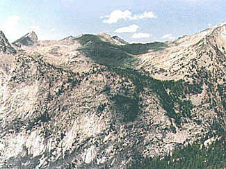
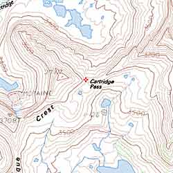
| Before Mather Pass was built, the John Muir trail went up Cartridge Creek, through Lake Basin, over Cartridge Pass (11,680'+) and down to the south fork of the Kings river. Although long since abandoned, much of this trail is still usable. This picture was taken from the top of Arrow Peak. In the foreground is the north wall of the canyon of the south fork. Map. |